
- Start >
- Rivers >
- Waterlevel >
- Oberer Main - Elbe >
- Unterzettlitz >
- Chart of year

Chart of year Unterzettlitz / Roter Main
Waterlevel from 01.01.2021 to 31.12.2021
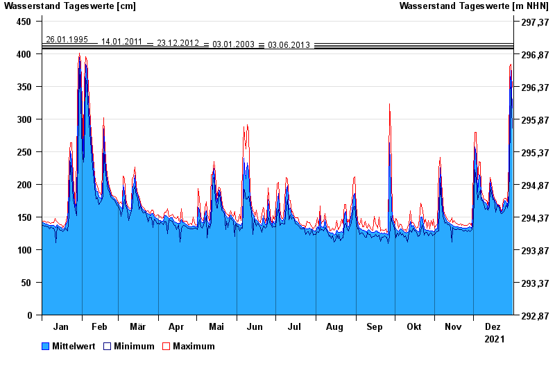
- 26.01.1995 Wasserstand: 416 cm
- 14.01.2011 Wasserstand: 413 cm
- 23.12.2012 Wasserstand: 410 cm
- 03.01.2003 Wasserstand: 408 cm
- 03.06.2013 Wasserstand: 407 cm
| Date | Mean value [cm] | Maximum [cm] | Minimum [cm] |
|---|---|---|---|
| 31.12.2021 | 317 | 349 | 286 |
| 30.12.2021 | 374 | 384 | 349 |
| 29.12.2021 | 336 | 379 | 234 |
| 28.12.2021 | 186 | 234 | 173 |
| 27.12.2021 | 167 | 173 | 164 |
| 26.12.2021 | 173 | 179 | 168 |
| 25.12.2021 | 175 | 179 | 160 |
© Bayerisches Landesamt für Umwelt 2024