
- Start >
- Rivers >
- Waterlevel >
- Oberer Main - Elbe >
- Unterzettlitz >
- Chart of year

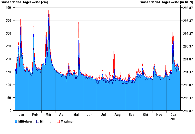
Chart of year Unterzettlitz / Roter Main
Waterlevel from 01.01.2019 to 31.12.2019
- 26.01.1995 Wasserstand: 416 cm
- 14.01.2011 Wasserstand: 413 cm
- 23.12.2012 Wasserstand: 410 cm
- 03.01.2003 Wasserstand: 408 cm
- 03.06.2013 Wasserstand: 407 cm
| Date | Mean value [cm] | Maximum [cm] | Minimum [cm] |
|---|---|---|---|
| 31.12.2019 | 150 | 152 | 142 |
| 30.12.2019 | 152 | 156 | 150 |
| 29.12.2019 | 156 | 159 | 149 |
| 28.12.2019 | 161 | 166 | 156 |
| 27.12.2019 | 169 | 174 | 165 |
| 26.12.2019 | 177 | 182 | 169 |
| 25.12.2019 | 182 | 185 | 178 |
© Bayerisches Landesamt für Umwelt 2024