
- Start >
- Rivers >
- Waterlevel >
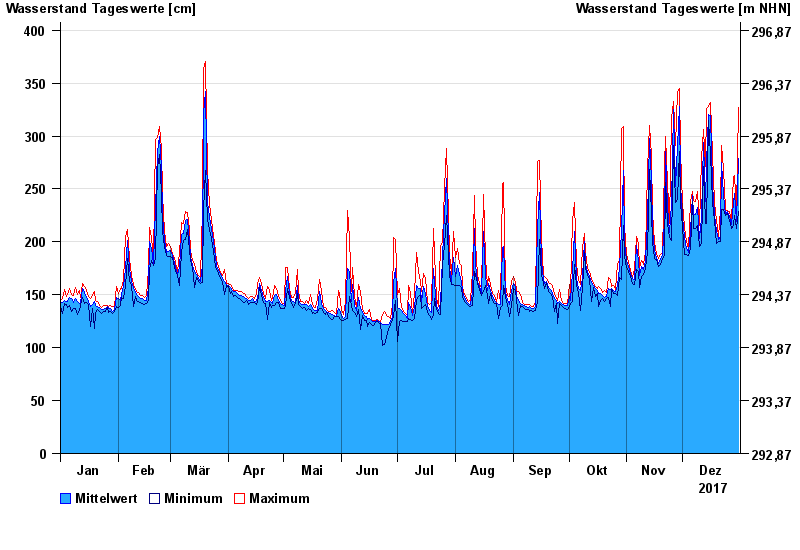
- Oberer Main - Elbe >
- Unterzettlitz >
- Chart of year

Chart of year Unterzettlitz / Roter Main
Waterlevel from 01.01.2017 to 31.12.2017
- 26.01.1995 Wasserstand: 416 cm
- 14.01.2011 Wasserstand: 413 cm
- 23.12.2012 Wasserstand: 410 cm
- 03.01.2003 Wasserstand: 408 cm
- 03.06.2013 Wasserstand: 407 cm
| Date | Mean value [cm] | Maximum [cm] | Minimum [cm] |
|---|---|---|---|
| 31.12.2017 | 279 | 327 | 229 |
| 30.12.2017 | 219 | 229 | 213 |
| 29.12.2017 | 246 | 263 | 225 |
| 28.12.2017 | 237 | 262 | 215 |
| 27.12.2017 | 216 | 220 | 213 |
| 26.12.2017 | 224 | 229 | 220 |
| 25.12.2017 | 229 | 230 | 227 |
© Bayerisches Landesamt für Umwelt 2024