
- Start >
- Rivers >
- Waterlevel >
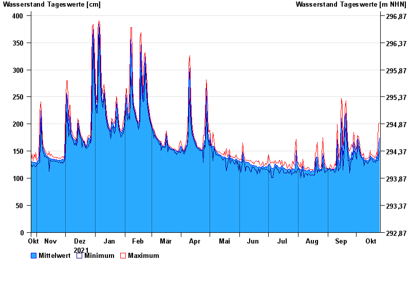
- Oberer Main - Elbe >
- Unterzettlitz >
- Chart of year

Chart of year Unterzettlitz / Roter Main
Waterlevel from 26.10.2021 to 25.10.2022
- 26.01.1995 Wasserstand: 416 cm
- 14.01.2011 Wasserstand: 413 cm
- 23.12.2012 Wasserstand: 410 cm
- 03.01.2003 Wasserstand: 408 cm
- 03.06.2013 Wasserstand: 407 cm
| Date | Mean value [cm] | Maximum [cm] | Minimum [cm] |
|---|---|---|---|
| 25.10.2022 | 174 | 202 | 149 |
| 24.10.2022 | 147 | 199 | 133 |
| 23.10.2022 | 136 | 142 | 132 |
| 22.10.2022 | 141 | 148 | 133 |
| 21.10.2022 | 133 | 140 | 129 |
| 20.10.2022 | 132 | 137 | 130 |
| 19.10.2022 | 136 | 141 | 129 |
© Bayerisches Landesamt für Umwelt 2024