
- Start >
- Rivers >
- Waterlevel >
- Oberer Main - Elbe >
- Unterzettlitz >
- Chart of total period

Chart of total period Unterzettlitz / Roter Main
Waterlevel from 28.10.1963 to 23.04.2024
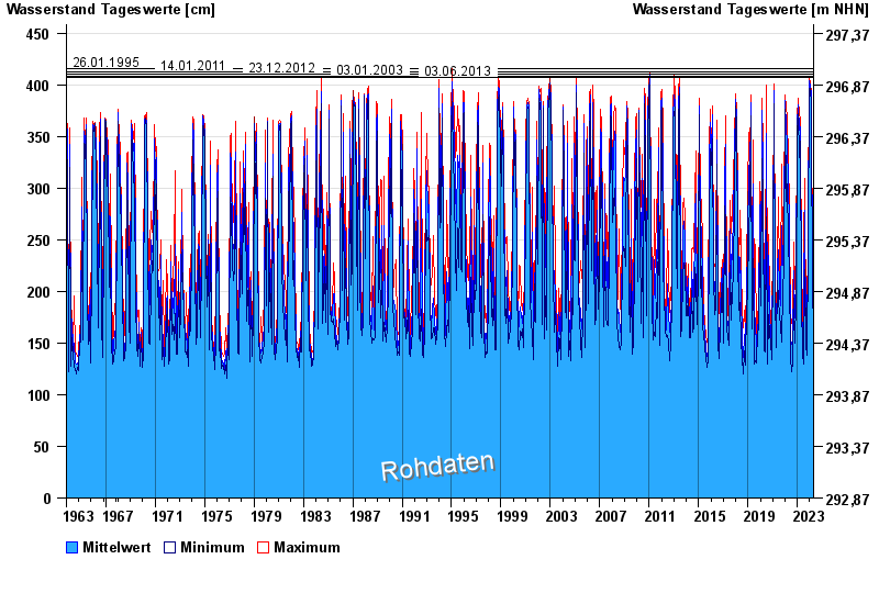
- 26.01.1995 Wasserstand: 416 cm
- 14.01.2011 Wasserstand: 413 cm
- 23.12.2012 Wasserstand: 410 cm
- 03.01.2003 Wasserstand: 408 cm
- 03.06.2013 Wasserstand: 407 cm
| Date | Mean value [cm] | Maximum [cm] | Minimum [cm] |
|---|---|---|---|
| 23.04.2024 | 242 | 256 | 233 |
| 22.04.2024 | 309 | 332 | 257 |
| 21.04.2024 | 243 | 313 | 219 |
| 20.04.2024 | 218 | 229 | 188 |
| 19.04.2024 | 162 | 188 | 155 |
| 18.04.2024 | 163 | 169 | 160 |
| 17.04.2024 | 168 | 178 | 158 |
© Bayerisches Landesamt für Umwelt 2024