
- Start >
- Rivers >
- Waterlevel >
- Oberer Main - Elbe >
- Unterzettlitz >
- Current values

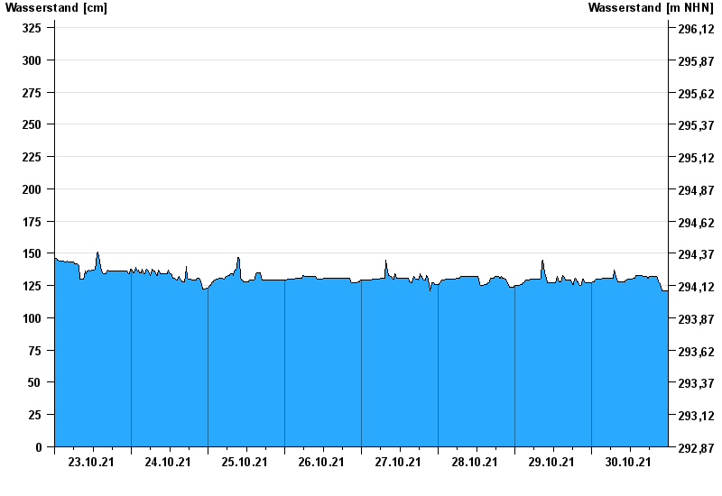
Current values Unterzettlitz / Roter Main
Waterlevel from 23.10.2021 to 30.10.2021
- 26.01.1995 Wasserstand: 416 cm
- 14.01.2011 Wasserstand: 413 cm
- 23.12.2012 Wasserstand: 410 cm
- 03.01.2003 Wasserstand: 408 cm
- 03.06.2013 Wasserstand: 407 cm
| Date | Waterlevel [cm] |
|---|---|
| 31.10.2021 00:45 | 122 |
| 31.10.2021 00:30 | 122 |
| 31.10.2021 00:15 | 121 |
| 31.10.2021 00:00 | 121 |
| 30.10.2021 23:45 | 121 |
| 30.10.2021 23:30 | 121 |
| 30.10.2021 23:15 | 121 |
© Bayerisches Landesamt für Umwelt 2024