
- Start >
- Rivers >
- Waterlevel >
- Oberer Main - Elbe >
- Untersteinach >
- Chart of month

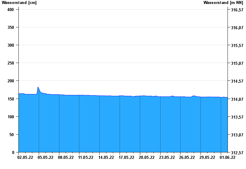
Chart of month Untersteinach / Schorgast
Waterlevel from 02.05.2022 to 01.06.2022
 Für diesen Pegel sind keine Hochwassermarken hinterlegt.
note
Schlechte Netzanbindung
| Date | Waterlevel [cm] |
|---|---|
| 02.06.2022 00:45 | 154 |
| 02.06.2022 00:30 | 154 |
| 02.06.2022 00:15 | 154 |
| 02.06.2022 00:00 | 154 |
| 01.06.2022 23:45 | 154 |
| 01.06.2022 23:30 | 154 |
| 01.06.2022 23:15 | 154 |
© Bayerisches Landesamt für Umwelt 2024