
- Start >
- Rivers >
- Waterlevel >
- Oberer Main - Elbe >
- Unterleinleiter >
- Chart of year

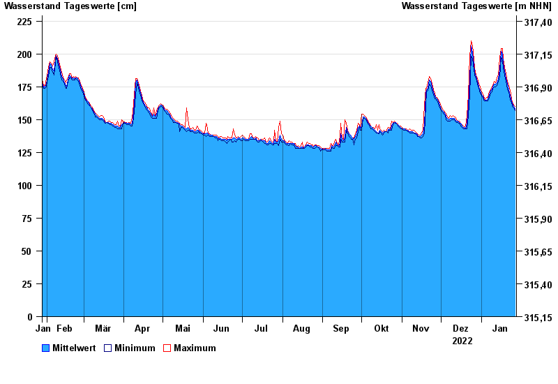
Chart of year Unterleinleiter / Leinleiterbach
Waterlevel from 28.01.2022 to 27.01.2023
- 14.01.2011 Wasserstand: 264 cm
- 27.05.2013 Wasserstand: 258 cm
- 13.02.2005 Wasserstand: 245 cm
- 27.03.2006 Wasserstand: 244 cm
- 30.01.2021 Wasserstand: 238 cm
| Date | Mean value [cm] | Maximum [cm] | Minimum [cm] |
|---|---|---|---|
| 27.01.2023 | 158 | 160 | 157 |
| 26.01.2023 | 160 | 161 | 159 |
| 25.01.2023 | 162 | 163 | 160 |
| 24.01.2023 | 164 | 166 | 163 |
| 23.01.2023 | 168 | 172 | 165 |
| 22.01.2023 | 173 | 176 | 171 |
| 21.01.2023 | 177 | 179 | 173 |
© Bayerisches Landesamt für Umwelt 2024