
- Start >
- Rivers >
- Waterlevel >
- Oberer Main - Elbe >
- Unterleinleiter >
- Chart of year

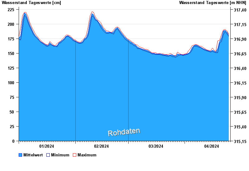
Chart of year Unterleinleiter / Leinleiterbach
Waterlevel from 01.01.2024 to 25.04.2024
- 14.01.2011 Wasserstand: 264 cm
- 27.05.2013 Wasserstand: 258 cm
- 13.02.2005 Wasserstand: 245 cm
- 27.03.2006 Wasserstand: 244 cm
- 30.01.2021 Wasserstand: 238 cm
| Date | Mean value [cm] | Maximum [cm] | Minimum [cm] |
|---|---|---|---|
| 25.04.2024 | 183 | 183 | 183 |
| 24.04.2024 | 186 | 188 | 183 |
| 23.04.2024 | 189 | 191 | 187 |
| 22.04.2024 | 188 | 190 | 182 |
| 21.04.2024 | 176 | 182 | 170 |
| 20.04.2024 | 170 | 172 | 167 |
| 19.04.2024 | 158 | 171 | 151 |
© Bayerisches Landesamt für Umwelt 2024