
- Start >
- Rivers >
- Waterlevel >
- Oberer Main - Elbe >
- Schwürbitz >
- Chart of year

Chart of year Schwürbitz / Main
Waterlevel from 23.01.2022 to 22.01.2023
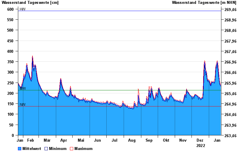
| Date | Mean value [cm] | Maximum [cm] | Minimum [cm] |
|---|---|---|---|
| 22.01.2023 | 235 | 239 | 232 |
| 21.01.2023 | 243 | 248 | 238 |
| 20.01.2023 | 253 | 259 | 248 |
| 19.01.2023 | 270 | 282 | 259 |
| 18.01.2023 | 295 | 308 | 282 |
| 17.01.2023 | 326 | 341 | 308 |
| 16.01.2023 | 350 | 354 | 341 |
© Bayerisches Landesamt für Umwelt 2024