
- Start >
- Rivers >
- Waterlevel >
- Oberer Main - Elbe >
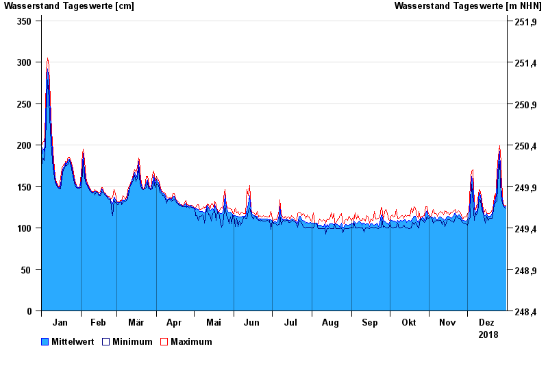
- Röbersdorf >
- Chart of year

Chart of year Röbersdorf / Reiche Ebrach
Waterlevel from 01.01.2018 to 31.12.2018
- 26.01.1995 Wasserstand: 410 cm
- 29.10.1998 Wasserstand: 394 cm
- 21.12.1993 Wasserstand: 390 cm
- 03.01.2003 Wasserstand: 381 cm
- 01.03.1987 Wasserstand: 381 cm
| Date | Mean value [cm] | Maximum [cm] | Minimum [cm] |
|---|---|---|---|
| 31.12.2018 | 126 | 127 | 124 |
| 30.12.2018 | 126 | 127 | 125 |
| 29.12.2018 | 128 | 130 | 127 |
| 28.12.2018 | 133 | 137 | 130 |
| 27.12.2018 | 149 | 180 | 137 |
| 26.12.2018 | 193 | 199 | 180 |
| 25.12.2018 | 178 | 187 | 168 |
© Bayerisches Landesamt für Umwelt 2024