
- Start >
- Rivers >
- Waterlevel >
- Oberer Main - Elbe >
- Röbersdorf >
- Chart of total period

Chart of total period Röbersdorf / Reiche Ebrach
Waterlevel from 01.11.1982 to 18.04.2024
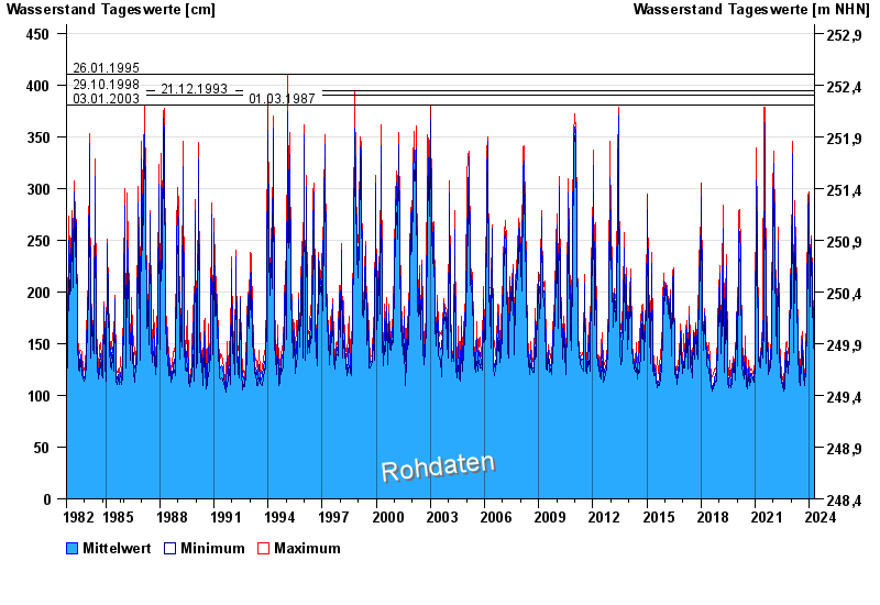
- 26.01.1995 Wasserstand: 410 cm
- 29.10.1998 Wasserstand: 394 cm
- 21.12.1993 Wasserstand: 390 cm
- 03.01.2003 Wasserstand: 381 cm
- 01.03.1987 Wasserstand: 381 cm
| Date | Mean value [cm] | Maximum [cm] | Minimum [cm] |
|---|---|---|---|
| 18.04.2024 | 133 | 133 | 133 |
| 17.04.2024 | 132 | 135 | 127 |
| 16.04.2024 | 125 | 128 | 124 |
| 15.04.2024 | 124 | 125 | 123 |
| 14.04.2024 | 125 | 127 | 124 |
| 13.04.2024 | 127 | 127 | 126 |
| 12.04.2024 | 125 | 127 | 125 |
© Bayerisches Landesamt für Umwelt 2024