
- Start >
- Rivers >
- Waterlevel >
- Oberer Main - Elbe >
- Röbersdorf >
- Current values

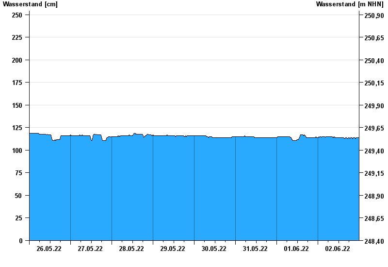
Current values Röbersdorf / Reiche Ebrach
Waterlevel from 26.05.2022 to 02.06.2022
- 26.01.1995 Wasserstand: 410 cm
- 29.10.1998 Wasserstand: 394 cm
- 21.12.1993 Wasserstand: 390 cm
- 03.01.2003 Wasserstand: 381 cm
- 01.03.1987 Wasserstand: 381 cm
| Date | Waterlevel [cm] |
|---|---|
| 03.06.2022 00:45 | 114 |
| 03.06.2022 00:30 | 114 |
| 03.06.2022 00:15 | 114 |
| 03.06.2022 00:00 | 114 |
| 02.06.2022 23:45 | 114 |
| 02.06.2022 23:30 | 114 |
| 02.06.2022 23:15 | 114 |
© Bayerisches Landesamt für Umwelt 2024