
- Start >
- Rivers >
- Waterlevel >
- Oberer Main - Elbe >
- Plankenfels >
- Chart of month

Chart of month Plankenfels / Truppach
Waterlevel from 01.04.2024 to 25.04.2024
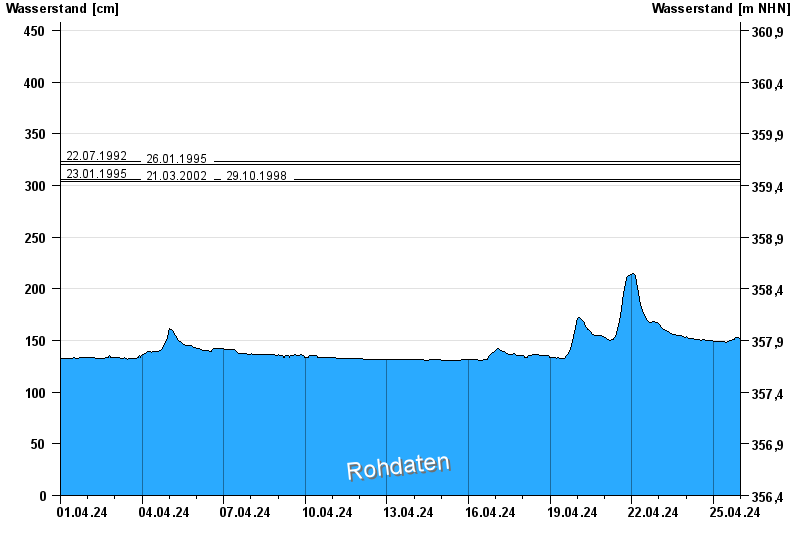
- 22.07.1992 Wasserstand: 323 cm
- 26.01.1995 Wasserstand: 320 cm
- 23.01.1995 Wasserstand: 306 cm
- 21.03.2002 Wasserstand: 304 cm
- 29.10.1998 Wasserstand: 304 cm
| Date | Waterlevel [cm] |
|---|---|
| 25.04.2024 07:00 | 149 |
| 25.04.2024 06:45 | 148 |
| 25.04.2024 06:30 | 149 |
| 25.04.2024 06:15 | 149 |
| 25.04.2024 06:00 | 149 |
| 25.04.2024 05:45 | 149 |
| 25.04.2024 05:30 | 148 |
© Bayerisches Landesamt für Umwelt 2024