
- Start >
- Rivers >
- Waterlevel >
- Oberer Main - Elbe >
- Oberkotzau >
- Chart of year

Chart of year Oberkotzau / Sächsische Saale
Waterlevel from 01.01.2024 to 20.04.2024
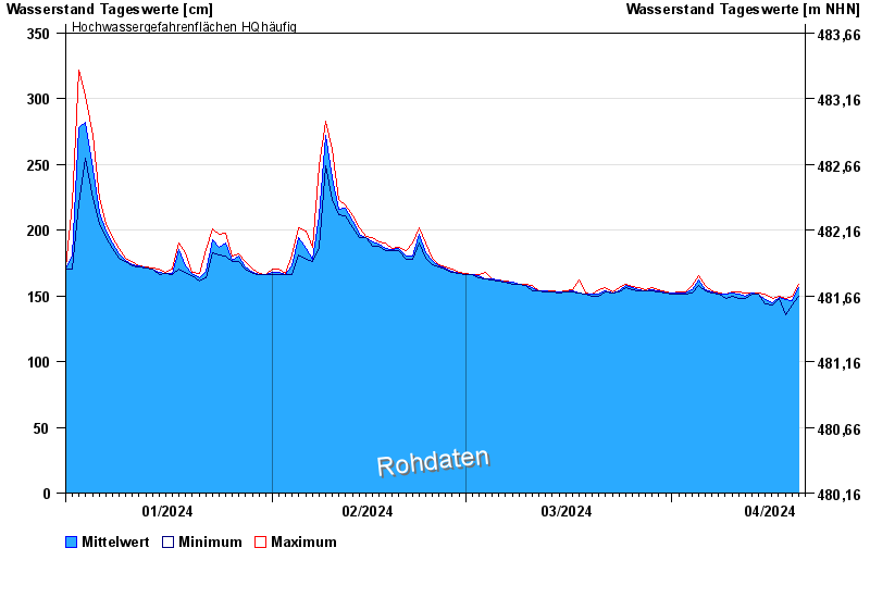
- Hochwassergefahrenfläche HQhäufig 350 cm
| Date | Mean value [cm] | Maximum [cm] | Minimum [cm] |
|---|---|---|---|
| 20.04.2024 | 155 | 158 | 150 |
| 19.04.2024 | 146 | 150 | 143 |
| 18.04.2024 | 147 | 148 | 136 |
| 17.04.2024 | 149 | 150 | 148 |
| 16.04.2024 | 145 | 148 | 143 |
| 15.04.2024 | 147 | 151 | 144 |
| 14.04.2024 | 151 | 152 | 151 |
© Bayerisches Landesamt für Umwelt 2024