
- Start >
- Rivers >
- Waterlevel >
- Oberer Main - Elbe >
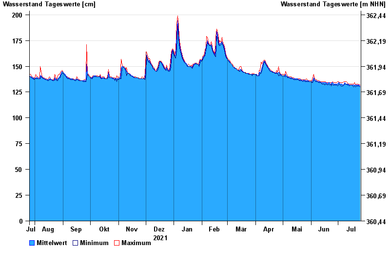
- Oberhammer >
- Chart of year

Chart of year Oberhammer / Untere Steinach
Waterlevel from 26.07.2021 to 25.07.2022
| Date | Mean value [cm] | Maximum [cm] | Minimum [cm] |
|---|---|---|---|
| 25.07.2022 | 131 | 132 | 130 |
| 24.07.2022 | 132 | 133 | 131 |
| 23.07.2022 | 132 | 132 | 131 |
| 22.07.2022 | 132 | 133 | 131 |
| 21.07.2022 | 132 | 133 | 131 |
| 20.07.2022 | 132 | 132 | 130 |
| 19.07.2022 | 132 | 134 | 131 |
© Bayerisches Landesamt für Umwelt 2024