
- Start >
- Rivers >
- Waterlevel >
- Oberer Main - Elbe >
- Michelfeld >
- Chart of year

Chart of year Michelfeld / Pegnitz
Waterlevel from 28.01.2024 to 27.01.2025
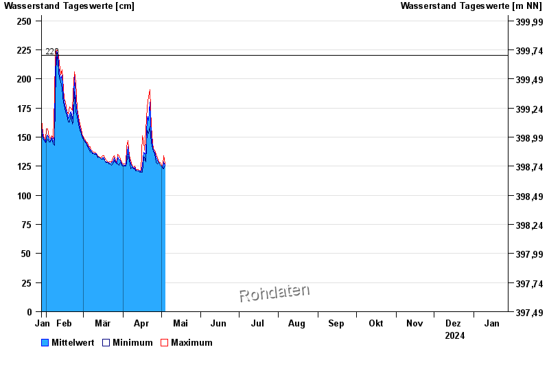
- 220 cm: Michelfeld: Überflutung der Straße am Pegel
| Date | Mean value [cm] | Maximum [cm] | Minimum [cm] |
|---|---|---|---|
| 25.04.2024 | 140 | 140 | 140 |
| 24.04.2024 | 142 | 145 | 140 |
| 23.04.2024 | 151 | 159 | 145 |
| 22.04.2024 | 180 | 191 | 159 |
| 21.04.2024 | 164 | 185 | 153 |
| 20.04.2024 | 168 | 176 | 156 |
| 19.04.2024 | 136 | 156 | 129 |
© Bayerisches Landesamt für Umwelt 2024