
- Start >
- Rivers >
- Waterlevel >
- Oberer Main - Elbe >
- Mauthaus >
- Chart of month

Chart of month Mauthaus / Nordhalbener Ködel
Waterlevel from 14.07.2020 to 13.08.2020
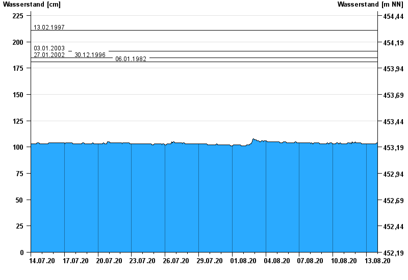
- 13.02.1997 Wasserstand: 211 cm
- 03.01.2003 Wasserstand: 191 cm
- 27.01.2002 Wasserstand: 185 cm
- 30.12.1996 Wasserstand: 185 cm
- 06.01.1982 Wasserstand: 181 cm
| Date | Waterlevel [cm] |
|---|---|
| 14.08.2020 00:45 | 103 |
| 14.08.2020 00:30 | 103 |
| 14.08.2020 00:15 | 103 |
| 14.08.2020 00:00 | 103 |
| 13.08.2020 23:45 | 104 |
| 13.08.2020 23:30 | 104 |
| 13.08.2020 23:15 | 104 |
© Bayerisches Landesamt für Umwelt 2024