
- Start >
- Rivers >
- Waterlevel >
- Oberer Main - Elbe >
- Mainleus >
- Chart of year

Chart of year Mainleus / Main
Waterlevel from 22.01.2022 to 21.01.2023
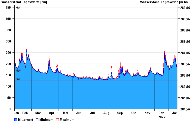
| Date | Mean value [cm] | Maximum [cm] | Minimum [cm] |
|---|---|---|---|
| 21.01.2023 | 183 | 186 | 181 |
| 20.01.2023 | 188 | 191 | 185 |
| 19.01.2023 | 196 | 201 | 191 |
| 18.01.2023 | 205 | 209 | 200 |
| 17.01.2023 | 216 | 222 | 209 |
| 16.01.2023 | 231 | 238 | 222 |
| 15.01.2023 | 223 | 236 | 211 |
© Bayerisches Landesamt für Umwelt 2024