
- Start >
- Rivers >
- Waterlevel >
- Oberer Main - Elbe >
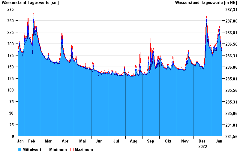
- Mainleus >
- Chart of year

Chart of year Mainleus / Main
Waterlevel from 21.01.2022 to 20.01.2023
- 26.01.1995 Wasserstand: 442 cm
- 13.02.2005 Wasserstand: 421 cm
- 14.01.2011 Wasserstand: 418 cm
- 21.12.1993 Wasserstand: 414 cm
- 28.05.2006 Wasserstand: 412 cm
| Date | Mean value [cm] | Maximum [cm] | Minimum [cm] |
|---|---|---|---|
| 20.01.2023 | 188 | 191 | 185 |
| 19.01.2023 | 196 | 201 | 191 |
| 18.01.2023 | 205 | 209 | 200 |
| 17.01.2023 | 216 | 222 | 209 |
| 16.01.2023 | 231 | 238 | 222 |
| 15.01.2023 | 223 | 236 | 211 |
| 14.01.2023 | 215 | 221 | 210 |
© Bayerisches Landesamt für Umwelt 2024