
- Start >
- Rivers >
- Waterlevel >
- Oberer Main - Elbe >
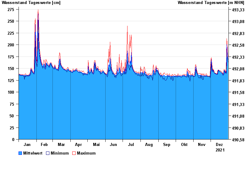
- Lorenzreuth >
- Chart of year

Chart of year Lorenzreuth / Röslau
Waterlevel from 01.01.2021 to 31.12.2021
- 28.05.2006 Wasserstand: 313 cm
- 01.11.1998 Wasserstand: 297 cm
- 12.02.2005 Wasserstand: 294 cm
- 03.01.2003 Wasserstand: 292 cm
- 07.12.2007 Wasserstand: 286 cm
| Date | Mean value [cm] | Maximum [cm] | Minimum [cm] |
|---|---|---|---|
| 31.12.2021 | 169 | 174 | 163 |
| 30.12.2021 | 178 | 193 | 174 |
| 29.12.2021 | 201 | 213 | 170 |
| 28.12.2021 | 146 | 170 | 140 |
| 27.12.2021 | 140 | 141 | 140 |
| 26.12.2021 | 142 | 144 | 141 |
| 25.12.2021 | 146 | 147 | 144 |
© Bayerisches Landesamt für Umwelt 2024