
- Start >
- Rivers >
- Waterlevel >
- Oberer Main - Elbe >
- Langenau >
- Chart of month

Chart of month Langenau / Langenaubach
Waterlevel from 01.07.2021 to 31.07.2021
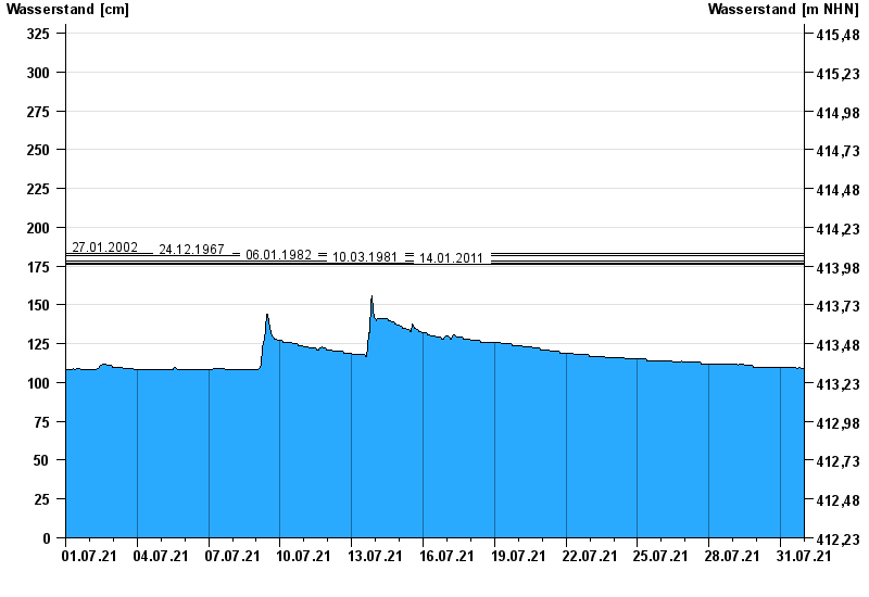
- 27.01.2002 Wasserstand: 183 cm
- 24.12.1967 Wasserstand: 182 cm
- 06.01.1982 Wasserstand: 178 cm
- 10.03.1981 Wasserstand: 177 cm
- 14.01.2011 Wasserstand: 176 cm
| Date | Waterlevel [cm] |
|---|---|
| 01.08.2021 00:45 | 109 |
| 01.08.2021 00:30 | 109 |
| 01.08.2021 00:15 | 109 |
| 01.08.2021 00:00 | 109 |
| 31.07.2021 23:45 | 109 |
| 31.07.2021 23:30 | 109 |
| 31.07.2021 23:15 | 109 |
© Bayerisches Landesamt für Umwelt 2024