
- Start >
- Rivers >
- Waterlevel >
- Oberer Main - Elbe >
- Kautendorf >
- Chart of month

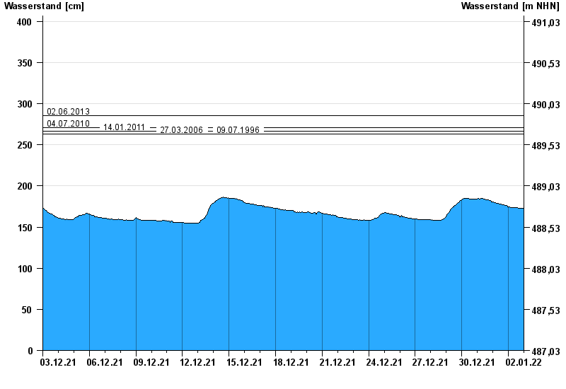
Chart of month Kautendorf / Südliche Regnitz
Waterlevel from 03.12.2021 to 02.01.2022
note
- 02.06.2013 Wasserstand: 286 cm
- 04.07.2010 Wasserstand: 271 cm
- 14.01.2011 Wasserstand: 267 cm
- 27.03.2006 Wasserstand: 263 cm
- 09.07.1996 Wasserstand: 263 cm
| Date | Waterlevel [cm] |
|---|---|
| 02.01.2022 23:45 | 172 |
| 02.01.2022 23:30 | 173 |
| 02.01.2022 23:15 | 173 |
| 02.01.2022 23:00 | 173 |
| 02.01.2022 22:45 | 173 |
| 02.01.2022 22:30 | 173 |
| 02.01.2022 22:15 | 173 |
© Bayerisches Landesamt für Umwelt 2024