
- Start >
- Rivers >
- Waterlevel >
- Oberer Main - Elbe >
- Kauerndorf >
- Chart of year

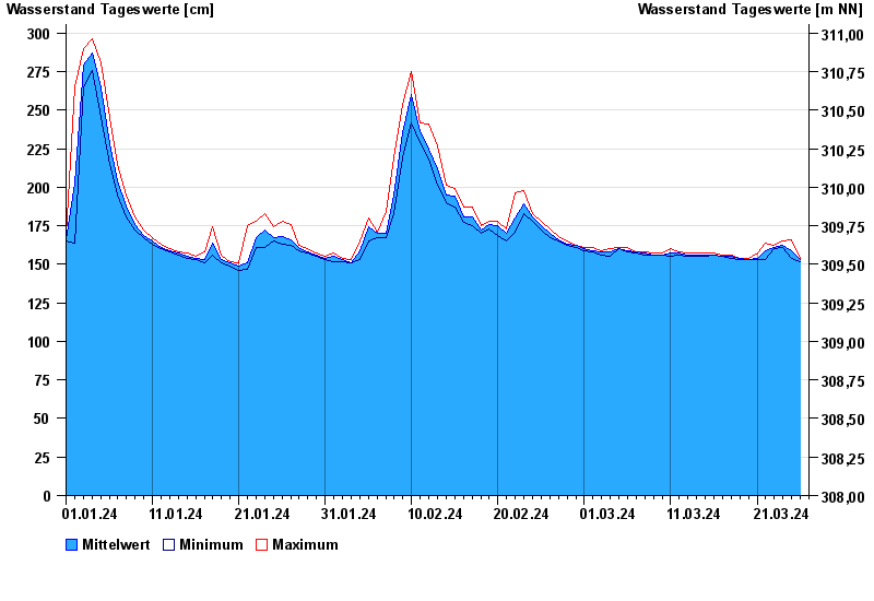
Chart of year Kauerndorf / Schorgast
Waterlevel from 01.01.2024 to 26.03.2024
 Für diesen Pegel sind keine Hochwassermarken hinterlegt.
note
Bauarbeiten am Pegel
| Date | Mean value [cm] | Maximum [cm] | Minimum [cm] |
|---|---|---|---|
| 26.03.2024 | 153 | 154 | 152 |
| 25.03.2024 | 159 | 166 | 154 |
| 24.03.2024 | 162 | 165 | 161 |
| 23.03.2024 | 161 | 162 | 160 |
| 22.03.2024 | 159 | 164 | 153 |
| 21.03.2024 | 154 | 157 | 153 |
| 20.03.2024 | 153 | 154 | 153 |
© Bayerisches Landesamt für Umwelt 2024