
- Start >
- Rivers >
- Waterlevel >
- Oberer Main - Elbe >
- Kauerndorf >
- Chart of month

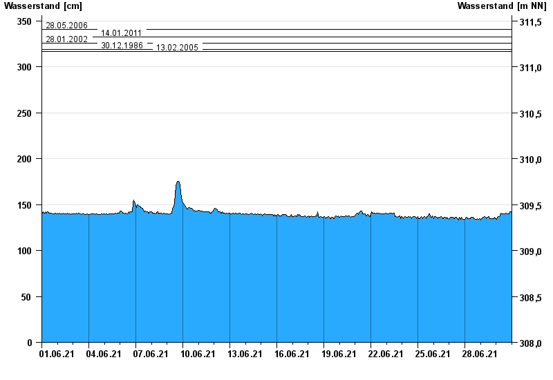
Chart of month Kauerndorf / Schorgast
Waterlevel from 01.06.2021 to 30.06.2021
note
Bauarbeiten am Pegel
- 28.05.2006 Wasserstand: 341 cm
- 14.01.2011 Wasserstand: 333 cm
- 28.01.2002 Wasserstand: 326 cm
- 30.12.1986 Wasserstand: 319 cm
- 13.02.2005 Wasserstand: 317 cm
| Date | Waterlevel [cm] |
|---|---|
| 01.07.2021 00:45 | 141 |
| 01.07.2021 00:30 | 142 |
| 01.07.2021 00:15 | 142 |
| 01.07.2021 00:00 | 142 |
| 30.06.2021 23:45 | 142 |
| 30.06.2021 23:30 | 142 |
| 30.06.2021 23:15 | 142 |
© Bayerisches Landesamt für Umwelt 2024