
- Start >
- Rivers >
- Waterlevel >
- Oberer Main - Elbe >
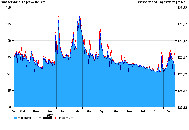
- Johannisthal >
- Chart of year

Chart of year Johannisthal / Tirschenreuther Waldnaab
Waterlevel from 27.09.2021 to 26.09.2022
- 02.11.1998 Wasserstand: 221 cm
- 03.01.2003 Wasserstand: 220 cm
- 14.01.2011 Wasserstand: 214 cm
- 13.02.2005 Wasserstand: 203 cm
- 03.06.2013 Wasserstand: 202 cm
| Date | Mean value [cm] | Maximum [cm] | Minimum [cm] |
|---|---|---|---|
| 26.09.2022 | 65 | 81 | 49 |
| 25.09.2022 | 65 | 67 | 64 |
| 24.09.2022 | 68 | 69 | 67 |
| 23.09.2022 | 69 | 70 | 67 |
| 22.09.2022 | 70 | 72 | 68 |
| 21.09.2022 | 71 | 74 | 53 |
| 20.09.2022 | 78 | 80 | 74 |
© Bayerisches Landesamt für Umwelt 2024