
- Start >
- Rivers >
- Waterlevel >
- Oberer Main - Elbe >
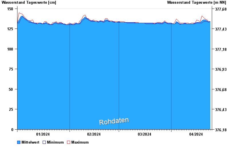
- Hollfeld >
- Chart of year

Chart of year Hollfeld / Wiesent
Waterlevel from 01.01.2024 to 24.04.2024
- 220 cm: Hollfeld: Linksseitige Ausuferung in das Wiesengelände unterhalb des Pegels.
| Date | Mean value [cm] | Maximum [cm] | Minimum [cm] |
|---|---|---|---|
| 24.04.2024 | 134 | 134 | 134 |
| 23.04.2024 | 134 | 134 | 133 |
| 22.04.2024 | 135 | 136 | 134 |
| 21.04.2024 | 136 | 137 | 134 |
| 20.04.2024 | 136 | 139 | 134 |
| 19.04.2024 | 135 | 142 | 132 |
| 18.04.2024 | 133 | 134 | 132 |
© Bayerisches Landesamt für Umwelt 2024