
- Start >
- Rivers >
- Waterlevel >
- Oberer Main - Elbe >
- Hof >
- Chart of year

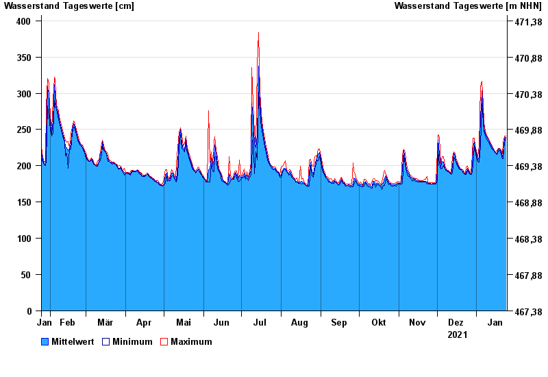
Chart of year Hof / Sächsische Saale
Waterlevel from 25.01.2021 to 24.01.2022
- 15.08.1924 Wasserstand: 428 cm
- 09.02.1946 Wasserstand: 420 cm
- 14.01.2011 Wasserstand: 416 cm
- 11.07.1954 Wasserstand: 414 cm
- 28.12.1947 Wasserstand: 410 cm
| Date | Mean value [cm] | Maximum [cm] | Minimum [cm] |
|---|---|---|---|
| 24.01.2022 | 239 | 241 | 238 |
| 23.01.2022 | 238 | 241 | 232 |
| 22.01.2022 | 217 | 232 | 210 |
| 21.01.2022 | 213 | 216 | 210 |
| 20.01.2022 | 219 | 222 | 216 |
| 19.01.2022 | 223 | 224 | 221 |
| 18.01.2022 | 223 | 224 | 220 |
© Bayerisches Landesamt für Umwelt 2024