
- Start >
- Rivers >
- Waterlevel >
- Oberer Main - Elbe >
- Hof >
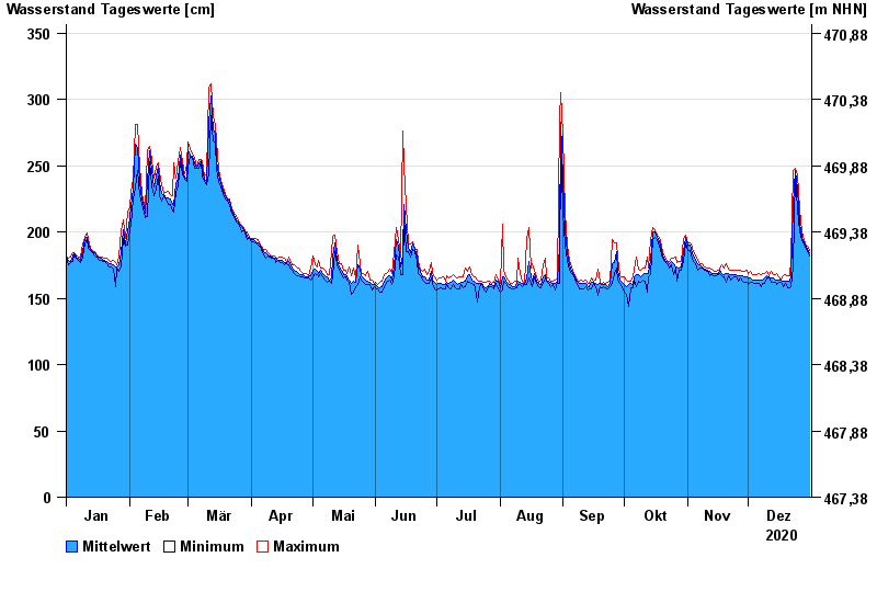
- Chart of year

Chart of year Hof / Sächsische Saale
Waterlevel from 01.01.2020 to 31.12.2020
- 15.08.1924 Wasserstand: 428 cm
- 09.02.1946 Wasserstand: 420 cm
- 14.01.2011 Wasserstand: 416 cm
- 11.07.1954 Wasserstand: 414 cm
- 28.12.1947 Wasserstand: 410 cm
| Date | Mean value [cm] | Maximum [cm] | Minimum [cm] |
|---|---|---|---|
| 31.12.2020 | 184 | 186 | 182 |
| 30.12.2020 | 187 | 189 | 185 |
| 29.12.2020 | 190 | 191 | 189 |
| 28.12.2020 | 192 | 194 | 190 |
| 27.12.2020 | 196 | 200 | 194 |
| 26.12.2020 | 207 | 217 | 200 |
| 25.12.2020 | 232 | 243 | 217 |
© Bayerisches Landesamt für Umwelt 2024