
- Start >
- Rivers >
- Waterlevel >
- Oberer Main - Elbe >
- Hof >
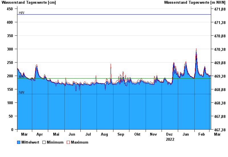
- Chart of year

Chart of year Hof / Sächsische Saale
Waterlevel from 04.03.2022 to 03.03.2023
| Date | Mean value [cm] | Maximum [cm] | Minimum [cm] |
|---|---|---|---|
| 03.03.2023 | 201 | 202 | 199 |
| 02.03.2023 | 200 | 202 | 199 |
| 01.03.2023 | 201 | 202 | 197 |
| 28.02.2023 | 199 | 202 | 198 |
| 27.02.2023 | 201 | 204 | 200 |
| 26.02.2023 | 206 | 207 | 203 |
| 25.02.2023 | 206 | 208 | 205 |
© Bayerisches Landesamt für Umwelt 2024