
- Start >
- Rivers >
- Waterlevel >
- Oberer Main - Elbe >
- Hof >
- Chart of year

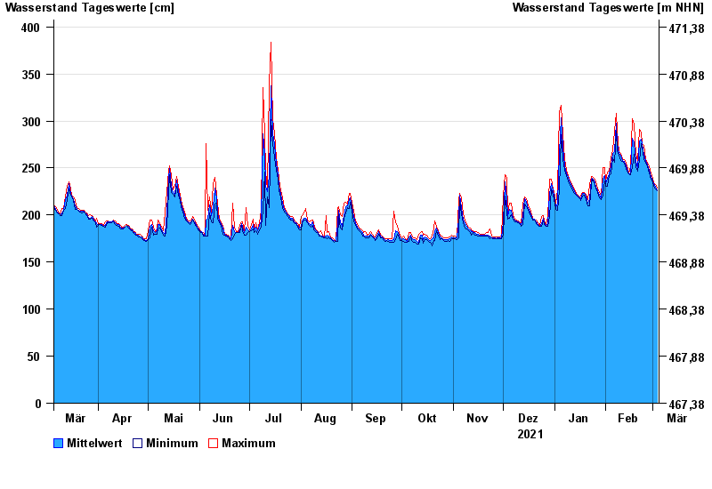
Chart of year Hof / Sächsische Saale
Waterlevel from 05.03.2021 to 04.03.2022
- 15.08.1924 Wasserstand: 428 cm
- 09.02.1946 Wasserstand: 420 cm
- 14.01.2011 Wasserstand: 416 cm
- 11.07.1954 Wasserstand: 414 cm
- 28.12.1947 Wasserstand: 410 cm
| Date | Mean value [cm] | Maximum [cm] | Minimum [cm] |
|---|---|---|---|
| 04.03.2022 | 227 | 229 | 226 |
| 03.03.2022 | 230 | 232 | 228 |
| 02.03.2022 | 233 | 234 | 231 |
| 01.03.2022 | 236 | 239 | 234 |
| 28.02.2022 | 241 | 245 | 238 |
| 27.02.2022 | 248 | 251 | 245 |
| 26.02.2022 | 253 | 255 | 251 |
© Bayerisches Landesamt für Umwelt 2024