
- Start >
- Rivers >
- Waterlevel >
- Oberer Main - Elbe >
- Hölle >
- Chart of year

Chart of year Hölle / Selbitz
Waterlevel from 15.07.2020 to 14.07.2021
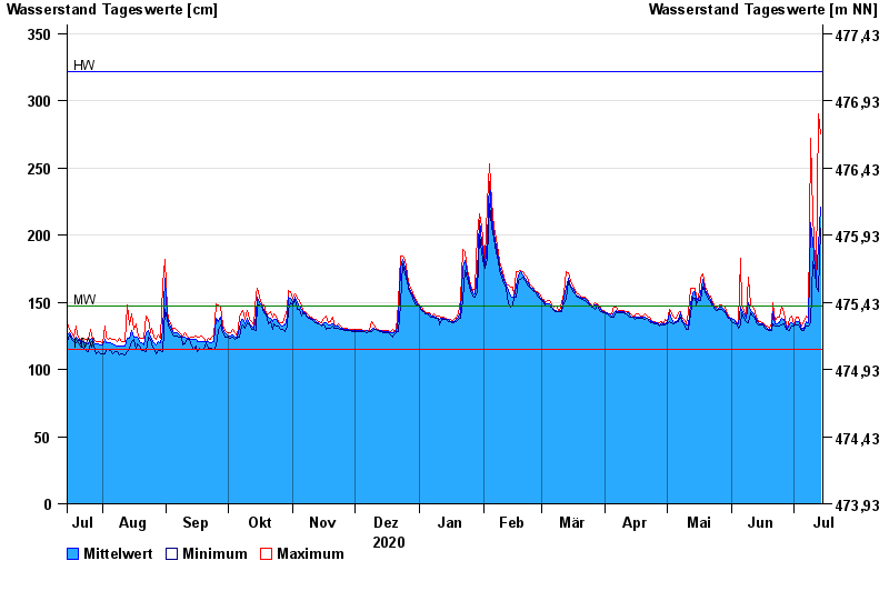
| Date | Mean value [cm] | Maximum [cm] | Minimum [cm] |
|---|---|---|---|
| 14.07.2021 | 221 | 275 | 205 |
| 13.07.2021 | 192 | 290 | 158 |
| 12.07.2021 | 168 | 174 | 162 |
| 11.07.2021 | 176 | 180 | 173 |
| 10.07.2021 | 195 | 215 | 180 |
| 09.07.2021 | 209 | 272 | 135 |
| 08.07.2021 | 135 | 139 | 132 |
© Bayerisches Landesamt für Umwelt 2024