
- Start >
- Rivers >
- Waterlevel >
- Oberer Main - Elbe >
- Heinersdorf >
- Chart of year

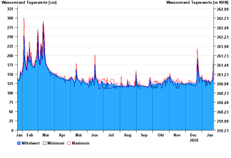
Chart of year Heinersdorf / Rodach
Waterlevel from 23.01.2020 to 22.01.2021
- 03.01.2003 Wasserstand: 426 cm
- 08.05.2004 Wasserstand: 413 cm
- 14.01.2011 Wasserstand: 412 cm
- 24.12.1967 Wasserstand: 409 cm
- 23.02.1970 Wasserstand: 401 cm
| Date | Mean value [cm] | Maximum [cm] | Minimum [cm] |
|---|---|---|---|
| 22.01.2021 | 176 | 196 | 144 |
| 21.01.2021 | 137 | 144 | 134 |
| 20.01.2021 | 134 | 135 | 132 |
| 19.01.2021 | 130 | 133 | 128 |
| 18.01.2021 | 128 | 130 | 128 |
| 17.01.2021 | 128 | 129 | 127 |
| 16.01.2021 | 127 | 131 | 121 |
© Bayerisches Landesamt für Umwelt 2024