
- Start >
- Rivers >
- Waterlevel >
- Oberer Main - Elbe >
- Heinersdorf >
- Chart of year

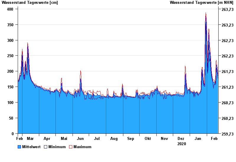
Chart of year Heinersdorf / Rodach
Waterlevel from 22.02.2020 to 21.02.2021
- 03.01.2003 Wasserstand: 426 cm
- 08.05.2004 Wasserstand: 413 cm
- 14.01.2011 Wasserstand: 412 cm
- 24.12.1967 Wasserstand: 409 cm
- 23.02.1970 Wasserstand: 401 cm
| Date | Mean value [cm] | Maximum [cm] | Minimum [cm] |
|---|---|---|---|
| 21.02.2021 | 185 | 191 | 178 |
| 20.02.2021 | 200 | 211 | 191 |
| 19.02.2021 | 219 | 225 | 211 |
| 18.02.2021 | 221 | 235 | 208 |
| 17.02.2021 | 174 | 231 | 159 |
| 16.02.2021 | 158 | 160 | 157 |
| 15.02.2021 | 162 | 168 | 156 |
© Bayerisches Landesamt für Umwelt 2024