
- Start >
- Rivers >
- Waterlevel >
- Oberer Main - Elbe >
- Goldbergsee Ablauf >
- Chart of month

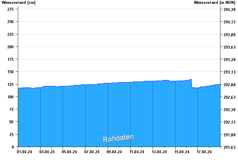
Chart of month Goldbergsee Ablauf / Sulzbach
Waterlevel from 01.04.2024 to 18.04.2024
 Für diesen Pegel sind keine Hochwassermarken hinterlegt.
note
Beeinflussung des Abflusses aufgrund Hindernisse im Unterlauf.
| Date | Waterlevel [cm] |
|---|---|
| 18.04.2024 06:30 | 123 |
| 18.04.2024 06:15 | 123 |
| 18.04.2024 06:00 | 123 |
| 18.04.2024 05:45 | 123 |
| 18.04.2024 05:30 | 123 |
| 18.04.2024 05:15 | 123 |
| 18.04.2024 05:00 | 123 |
© Bayerisches Landesamt für Umwelt 2024