
- Start >
- Rivers >
- Waterlevel >
- Oberer Main - Elbe >
- Geschwend >
- Chart of total period

Chart of total period Geschwend / Kremnitz
Waterlevel from 26.10.1964 to 24.04.2024
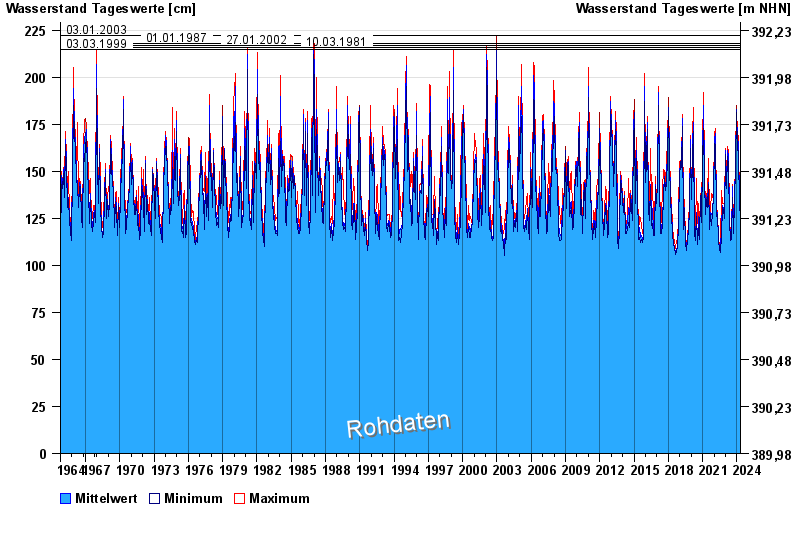
- 03.01.2003 Wasserstand: 222 cm
- 01.01.1987 Wasserstand: 218 cm
- 27.01.2002 Wasserstand: 217 cm
- 10.03.1981 Wasserstand: 216 cm
- 03.03.1999 Wasserstand: 215 cm
| Date | Mean value [cm] | Maximum [cm] | Minimum [cm] |
|---|---|---|---|
| 24.04.2024 | 132 | 132 | 132 |
| 23.04.2024 | 133 | 134 | 132 |
| 22.04.2024 | 132 | 133 | 131 |
| 21.04.2024 | 131 | 133 | 130 |
| 20.04.2024 | 130 | 131 | 128 |
| 19.04.2024 | 125 | 129 | 121 |
| 18.04.2024 | 123 | 123 | 122 |
© Bayerisches Landesamt für Umwelt 2024