
- Start >
- Rivers >
- Waterlevel >
- Oberer Main - Elbe >
- Gampelmühle >
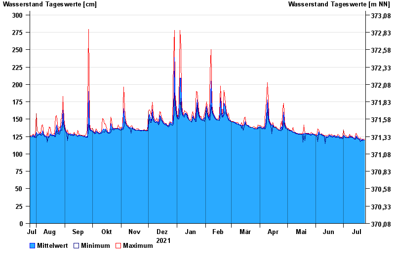
- Chart of year

Chart of year Gampelmühle / Ölschnitz
Waterlevel from 25.07.2021 to 24.07.2022
- 06.06.1984 Wasserstand: 357 cm
- 28.05.2006 Wasserstand: 348 cm
- 26.01.1995 Wasserstand: 344 cm
- 07.07.2006 Wasserstand: 343 cm
- 03.01.2003 Wasserstand: 340 cm
| Date | Mean value [cm] | Maximum [cm] | Minimum [cm] |
|---|---|---|---|
| 24.07.2022 | 120 | 121 | 120 |
| 23.07.2022 | 120 | 121 | 120 |
| 22.07.2022 | 121 | 121 | 119 |
| 21.07.2022 | 120 | 121 | 119 |
| 20.07.2022 | 120 | 121 | 119 |
| 19.07.2022 | 121 | 123 | 118 |
| 18.07.2022 | 122 | 122 | 121 |
© Bayerisches Landesamt für Umwelt 2024