
- Start >
- Rivers >
- Waterlevel >
- Oberer Main - Elbe >
- Gampelmühle >
- Chart of year

Chart of year Gampelmühle / Ölschnitz
Waterlevel from 01.01.2020 to 31.12.2020
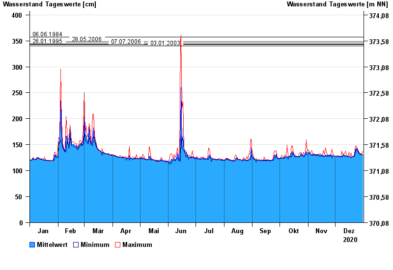
- 06.06.1984 Wasserstand: 357 cm
- 28.05.2006 Wasserstand: 348 cm
- 26.01.1995 Wasserstand: 344 cm
- 07.07.2006 Wasserstand: 343 cm
- 03.01.2003 Wasserstand: 340 cm
| Date | Mean value [cm] | Maximum [cm] | Minimum [cm] |
|---|---|---|---|
| 31.12.2020 | 130 | 138 | 130 |
| 30.12.2020 | 131 | 132 | 130 |
| 29.12.2020 | 132 | 133 | 131 |
| 28.12.2020 | 132 | 132 | 131 |
| 27.12.2020 | 133 | 134 | 132 |
| 26.12.2020 | 136 | 138 | 134 |
| 25.12.2020 | 140 | 143 | 138 |
© Bayerisches Landesamt für Umwelt 2024