
- Start >
- Rivers >
- Waterlevel >
- Oberer Main - Elbe >
- Friedersreuth >
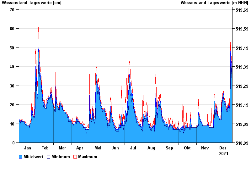
- Chart of year

Chart of year Friedersreuth / Schweinnaab
Waterlevel from 01.01.2021 to 31.12.2021
 Für diesen Pegel sind keine Hochwassermarken hinterlegt.
| Date | Mean value [cm] | Maximum [cm] | Minimum [cm] |
|---|---|---|---|
| 31.12.2021 | 37 | 42 | 34 |
| 30.12.2021 | 45 | 47 | 42 |
| 29.12.2021 | 48 | 53 | 39 |
| 28.12.2021 | 23 | 39 | 17 |
| 27.12.2021 | 18 | 18 | 17 |
| 26.12.2021 | 18 | 19 | 18 |
| 25.12.2021 | 20 | 21 | 19 |
© Bayerisches Landesamt für Umwelt 2024