
- Start >
- Rivers >
- Waterlevel >
- Oberer Main - Elbe >
- Friedersdorf >
- Chart of year

Chart of year Friedersdorf / Buchbach
Waterlevel from 29.10.2023 to 28.10.2024
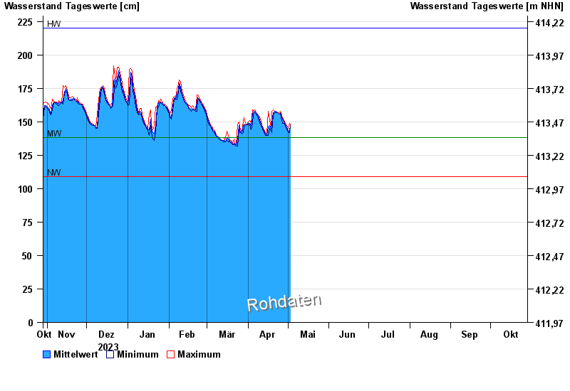
| Date | Mean value [cm] | Maximum [cm] | Minimum [cm] |
|---|---|---|---|
| 23.04.2024 | 157 | 157 | 157 |
| 22.04.2024 | 158 | 158 | 157 |
| 21.04.2024 | 158 | 158 | 157 |
| 20.04.2024 | 157 | 159 | 155 |
| 19.04.2024 | 149 | 158 | 142 |
| 18.04.2024 | 145 | 146 | 143 |
| 17.04.2024 | 147 | 151 | 145 |
© Bayerisches Landesamt für Umwelt 2024