
- Start >
- Rivers >
- Waterlevel >
- Oberer Main - Elbe >
- Förmitz Speicherzufluss >
- Chart of month

Chart of month Förmitz Speicherzufluss / Förmitz
Waterlevel from 01.06.2021 to 30.06.2021
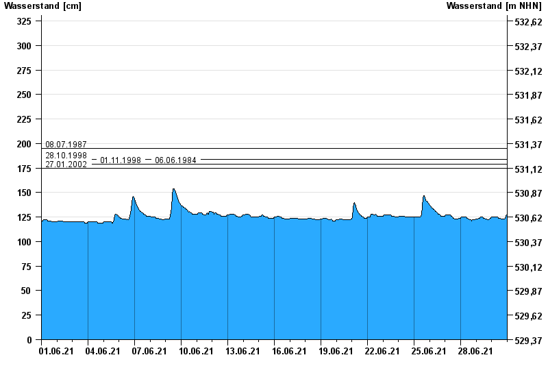
- 08.07.1987 Wasserstand: 195 cm
- 28.10.1998 Wasserstand: 184 cm
- 01.11.1998 Wasserstand: 179 cm
- 06.06.1984 Wasserstand: 179 cm
- 27.01.2002 Wasserstand: 175 cm
| Date | Waterlevel [cm] |
|---|---|
| 01.07.2021 00:45 | 127 |
| 01.07.2021 00:30 | 127 |
| 01.07.2021 00:15 | 127 |
| 01.07.2021 00:00 | 127 |
| 30.06.2021 23:45 | 127 |
| 30.06.2021 23:30 | 127 |
| 30.06.2021 23:15 | 127 |
© Bayerisches Landesamt für Umwelt 2024