
- Start >
- Rivers >
- Waterlevel >
- Oberer Main - Elbe >
- Förmitz Speicherabfluss >
- Chart of month

Chart of month Förmitz Speicherabfluss / Förmitz
Waterlevel from 01.08.2021 to 31.08.2021
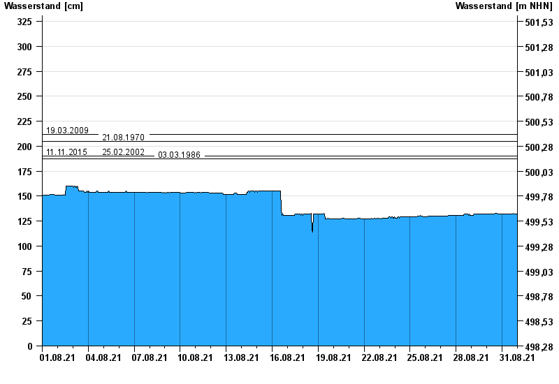
- 19.03.2009 Wasserstand: 212 cm
- 21.08.1970 Wasserstand: 205 cm
- 11.11.2015 Wasserstand: 190 cm
- 25.02.2002 Wasserstand: 190 cm
- 03.03.1986 Wasserstand: 187 cm
| Date | Waterlevel [cm] |
|---|---|
| 01.09.2021 00:45 | 132 |
| 01.09.2021 00:30 | 132 |
| 01.09.2021 00:15 | 132 |
| 01.09.2021 00:00 | 132 |
| 31.08.2021 23:45 | 132 |
| 31.08.2021 23:30 | 132 |
| 31.08.2021 23:15 | 132 |
© Bayerisches Landesamt für Umwelt 2024