
- Start >
- Rivers >
- Waterlevel >
- Oberer Main - Elbe >
- Dobrigau >
- Chart of month

Chart of month Dobrigau / Wondreb
Waterlevel from 01.04.2024 to 26.04.2024
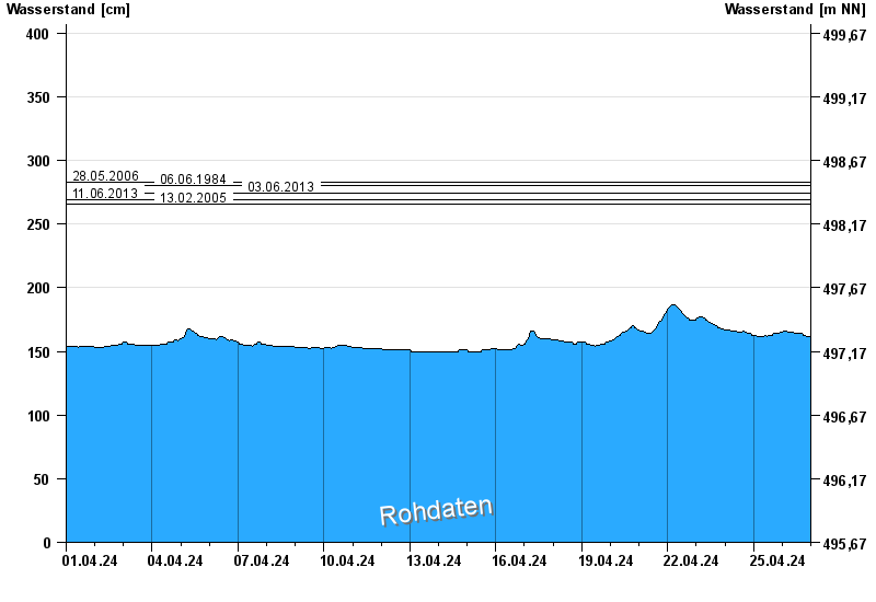
- 28.05.2006 Wasserstand: 283 cm
- 06.06.1984 Wasserstand: 280 cm
- 03.06.2013 Wasserstand: 274 cm
- 11.06.2013 Wasserstand: 269 cm
- 13.02.2005 Wasserstand: 266 cm
| Date | Waterlevel [cm] |
|---|---|
| 26.04.2024 01:45 | 166 |
| 26.04.2024 01:30 | 166 |
| 26.04.2024 01:15 | 166 |
| 26.04.2024 01:00 | 166 |
| 26.04.2024 00:45 | 166 |
| 26.04.2024 00:30 | 165 |
| 26.04.2024 00:15 | 165 |
© Bayerisches Landesamt für Umwelt 2024