
- Start >
- Rivers >
- Waterlevel >
- Oberer Main - Elbe >
- Bärenthal >
- Chart of month

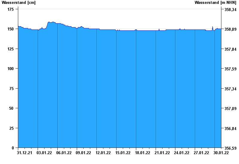
Chart of month Bärenthal / Trubach
Waterlevel from 31.12.2021 to 30.01.2022
note
Absinken des Wasserstandes wegen Entfernung von Auflandungen.
- Hochwassergefahrenfläche HQ100 220 cm
| Date | Waterlevel [cm] |
|---|---|
| 30.01.2022 23:45 | 150 |
| 30.01.2022 23:30 | 150 |
| 30.01.2022 23:15 | 150 |
| 30.01.2022 23:00 | 150 |
| 30.01.2022 22:45 | 150 |
| 30.01.2022 22:30 | 150 |
| 30.01.2022 22:15 | 150 |
© Bayerisches Landesamt für Umwelt 2024