
- Start >
- Rivers >
- Waterlevel >
- Oberer Main - Elbe >
- Autenhausen >
- Chart of month

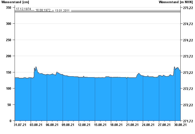
Chart of month Autenhausen / Kreck
Waterlevel from 31.07.2021 to 30.08.2021
- 23.02.1970 Wasserstand: 370 cm
- 03.01.2003 Wasserstand: 363 cm
- 17.12.1974 Wasserstand: 341 cm
- 16.08.1972 Wasserstand: 337 cm
- 13.01.2011 Wasserstand: 336 cm
| Date | Waterlevel [cm] |
|---|---|
| 31.08.2021 00:45 | 153 |
| 31.08.2021 00:30 | 153 |
| 31.08.2021 00:15 | 154 |
| 31.08.2021 00:00 | 154 |
| 30.08.2021 23:45 | 154 |
| 30.08.2021 23:30 | 154 |
| 30.08.2021 23:15 | 154 |
© Bayerisches Landesamt für Umwelt 2024