
- Start >
- Rivers >
- Waterlevel >
- Oberer Main - Elbe >
- Adlerhütte >
- Current values

Current values Adlerhütte / Koserbach
Waterlevel from 05.01.2021 to 11.01.2021
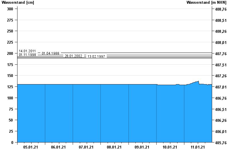
- 14.01.2011 Wasserstand: 201 cm
- 01.04.1988 Wasserstand: 196 cm
- 01.11.1998 Wasserstand: 193 cm
- 28.01.2002 Wasserstand: 190 cm
- 13.02.1997 Wasserstand: 189 cm
| Date | Waterlevel [cm] |
|---|---|
| 11.01.2021 23:45 | 129 |
| 11.01.2021 23:30 | 130 |
| 11.01.2021 23:15 | 130 |
| 11.01.2021 23:00 | 130 |
| 11.01.2021 22:45 | 130 |
| 11.01.2021 22:30 | 130 |
| 11.01.2021 22:15 | 130 |
© Bayerisches Landesamt für Umwelt 2024