
- Start >
- Rivers >
- Waterlevel >
- Bayern >
- Vilshofen >
- Chart of year

Chart of year Vilshofen / Donau
Waterlevel from 01.01.2021 to 31.12.2021
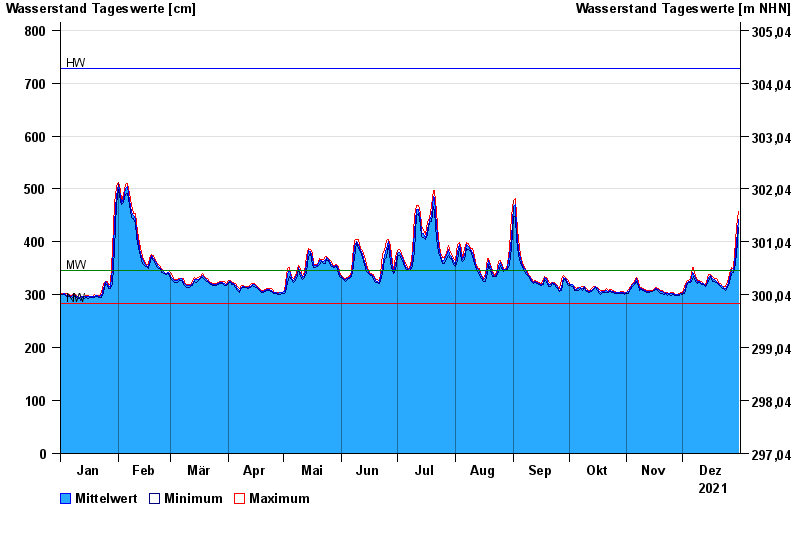
| Date | Mean value [cm] | Maximum [cm] | Minimum [cm] |
|---|---|---|---|
| 31.12.2021 | 443 | 457 | 427 |
| 30.12.2021 | 399 | 427 | 376 |
| 29.12.2021 | 359 | 376 | 346 |
| 28.12.2021 | 346 | 349 | 342 |
| 27.12.2021 | 348 | 352 | 340 |
| 26.12.2021 | 330 | 340 | 323 |
| 25.12.2021 | 317 | 323 | 313 |
© Bayerisches Landesamt für Umwelt 2024