
- Start >
- Rivers >
- Waterlevel >
- Bayern >
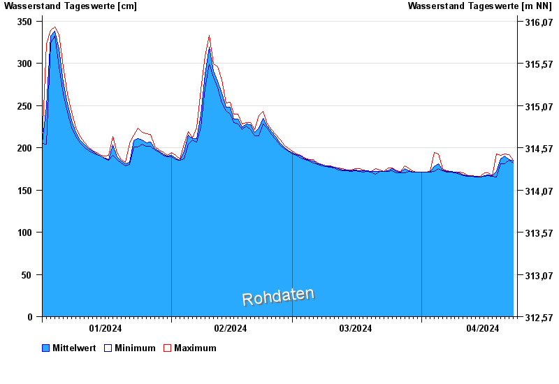
- Untersteinach >
- Chart of year

Chart of year Untersteinach / Schorgast
Waterlevel from 01.01.2024 to 23.04.2024
note
Schlechte Netzanbindung
- 28.05.2006 Wasserstand: 379 cm
- 03.01.2003 Wasserstand: 373 cm
- 01.11.1998 Wasserstand: 367 cm
- 13.02.2005 Wasserstand: 357 cm
- 16.09.1998 Wasserstand: 357 cm
| Date | Mean value [cm] | Maximum [cm] | Minimum [cm] |
|---|---|---|---|
| 23.04.2024 | 185 | 185 | 184 |
| 22.04.2024 | 186 | 192 | 185 |
| 21.04.2024 | 190 | 193 | 181 |
| 20.04.2024 | 187 | 191 | 181 |
| 19.04.2024 | 172 | 193 | 165 |
| 18.04.2024 | 167 | 167 | 166 |
| 17.04.2024 | 168 | 170 | 167 |
© Bayerisches Landesamt für Umwelt 2024