
- Start >
- Rivers >
- Waterlevel >
- Bayern >
- Unterbruck >
- Chart of year

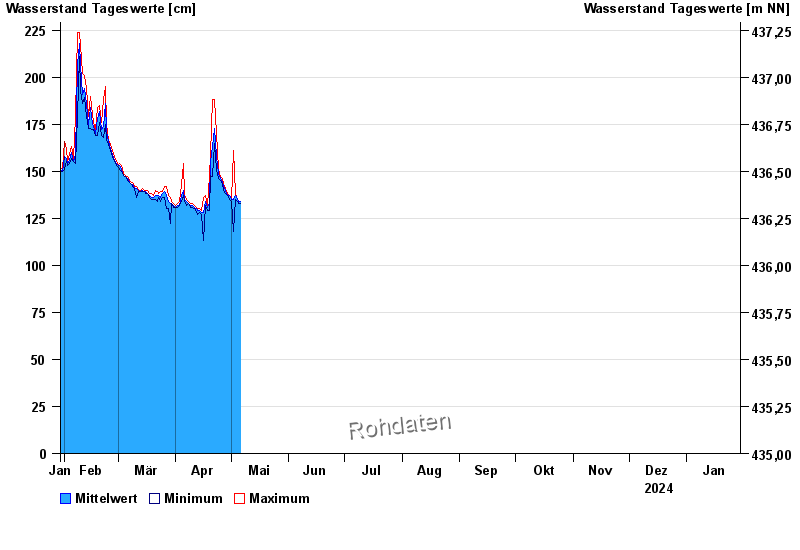
Chart of year Unterbruck / Haidenaab
Waterlevel from 30.01.2024 to 29.01.2025
- Hochwassergefahrenfläche HQ100 320 cm
| Date | Mean value [cm] | Maximum [cm] | Minimum [cm] |
|---|---|---|---|
| 24.04.2024 | 150 | 151 | 149 |
| 23.04.2024 | 158 | 170 | 151 |
| 22.04.2024 | 173 | 188 | 165 |
| 21.04.2024 | 163 | 188 | 147 |
| 20.04.2024 | 155 | 159 | 148 |
| 19.04.2024 | 133 | 148 | 129 |
| 18.04.2024 | 131 | 132 | 129 |
© Bayerisches Landesamt für Umwelt 2024