
- Start >
- Rivers >
- Waterlevel >
- Bayern >
- Trausnitz u. d. Mühle >
- Chart of year

Chart of year Trausnitz u. d. Mühle / Pfreimd
Waterlevel from 01.01.2024 to 17.04.2024
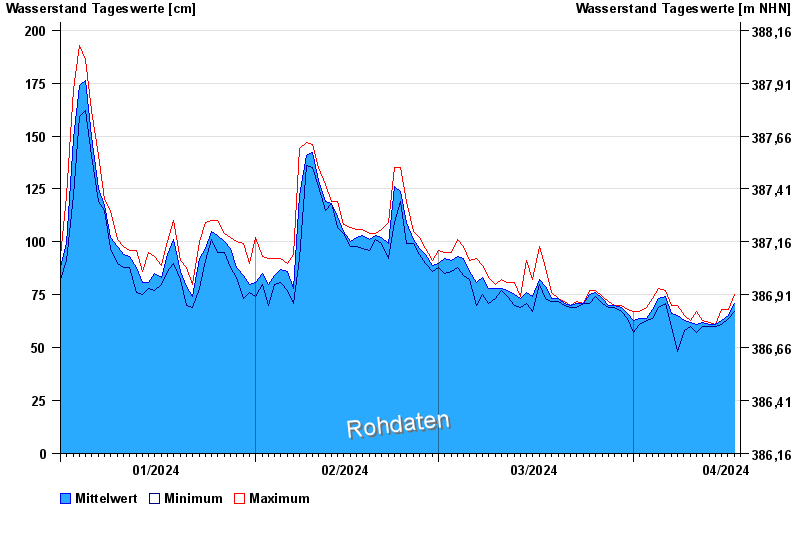
| Date | Mean value [cm] | Maximum [cm] | Minimum [cm] |
|---|---|---|---|
| 17.04.2024 | 68 | 71 | 67 |
| 16.04.2024 | 65 | 68 | 64 |
| 15.04.2024 | 63 | 68 | 61 |
| 14.04.2024 | 61 | 61 | 60 |
| 13.04.2024 | 61 | 62 | 60 |
| 12.04.2024 | 62 | 63 | 60 |
| 11.04.2024 | 61 | 67 | 57 |
© Bayerisches Landesamt für Umwelt 2024